Countrywide Pointcloud, DSM and TrueOrtho
Our countrywide heightmodel (DSM) and TrueOrtho of the Netherlands are updated! We are using the latest aerial imagery and the latest version of our matching algorithm. We now also made a pointcloud available for the entire country.
Point cloud
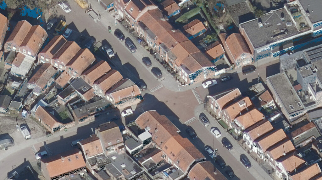
By using overlapping aerial photos, we can use the stereo image to determine the height of each pixel. This creates a point cloud.
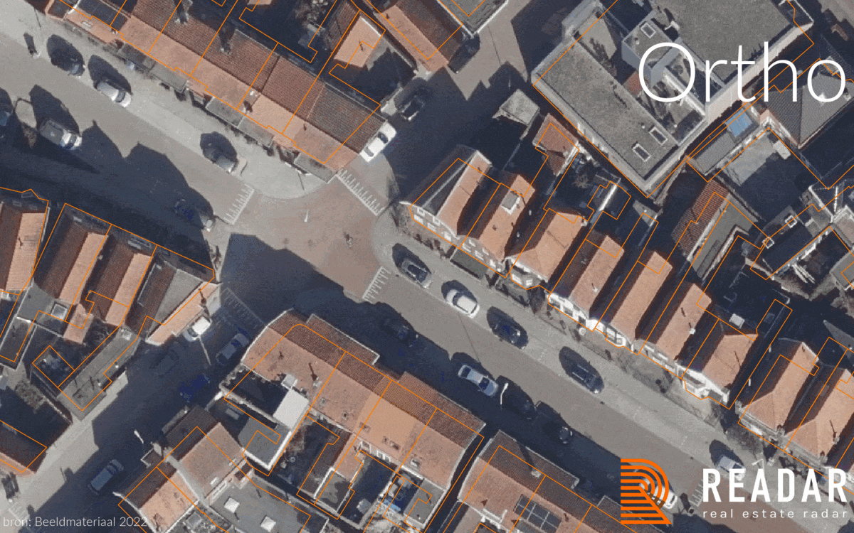
TrueOrtho
If we view the colored point cloud from the top, we can create an aerial image without perspective or building lean: the TrueOrtho. In a traditional orthophoto the images are projected on a flat ground surface. Therefore an orthophoto will deviate from a base maps such as a building map. A TrueOrtho will have a perfect fit with all your basemaps. This ensures that any information on buildings are related to the correct building and address.This is vital for building information such as the presence of solar panels, dormers and roof material This also makes it much easier to spot errors in you base map. A TrueOrtho is therefore perfect for change detection.
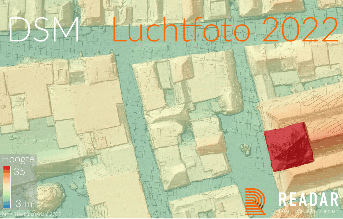
Height model (DSM)
We can also view the pointcloud from the top but do not take the color value but the height value. This will create an elevation map or Digital Surface Model, DSM. Compared to a LiDAR DSM (AHN) we can clearly see that a DSM from aerial imagery achieves a much higher resolution. When we compare it to last years DSM we see the huge improvement we made in our processing software. Edges are more clear and flat surfaces more flat.
Receive sample data?
Point cloud: You can view part of our pointcloud directly in your browser. If you would like to receive a LAZ download, please contact us.
Height Model/DSM/TrueOrtho: We have prepared a test area of 100km2 for the height model and TrueOrtho. If you want to see this data, then please send an email to proefdata@readar.com with your name, phone number and the name of your organization and we will make sure you receive the data.
Access via download or API
Would you like to use the national aerial photo, our elevation model, or our TrueOrtho? The storage space required for this data is considerable. We can imagine that you prefer not to store this data yourself, in that case you can use our API, download the API-documentatie.
On demand processing
Do you have stereo imagery available that you want to process into a height model and TrueOrtho? Then please contact us for the details.